ExploreATL.com
  • Choose Your Own Adventure
PREMIUM CONTENT
This page accessible to paying subscribers of ATLsherpa

SE ATL Tour Stops

This page is for clients only. Please do not share your log-in credentials. Thank you.
Picture
Picture
Picture
Picture
Picture

Stop #1: Oakland City Transit Station

Oakland City is on the Red and Gold Lines. There is a surface parking lot with 337 spaces. This station has local MARTA bus service.  The station has a main entrance from Campbellton Road and a pedestrian tunnel at the Murphy Avenue entrance.  Residential housing and neighborhood parks surround the station. Opened: ​December 15, 1984

IMPORTANT: The most recent More MARTA Plan calls for a key connection at the Oakland City station between a new Bus Rapid Transit (BRT) line coming up Campbellton Road (from the Greenbriar Mall area) and a new Light Rail Transit (LRT) line which will run along the Atlanta Beltline Westside Trail. SEE ALSO: Westside Trail stop below...
Picture
Picture
STATION PROFILE

Stop #2: Southside Trail

This 4-mile segment of the Atlanta Beltline Redevelopment Plan represents a critical link between the east and west sides of Atlanta, which are geographically separated by the I-75/I-85 freeway. When completed, multi-use trail users will be able to bike or walk from Piedmont Park to Washington Park, which is about 
Picture
Picture
Picture
Picture
​On February 17, 2020, construction crews will install security fencing and officially close the western portion of the Southside Trail in order to begin early construction activities. The interim trail will be closed at the paved southern terminus of the Westside Trail, the concrete access point at University Avenue, the stairs at Metropolitan Avenue, and west of the stairs at Pryor Road. The closure will extend between University Avenue and Pryor Road, so trail users will need to exit the corridor and use sidewalks along surface streets between the two locations. [SEE THIS MAP]

Stop #3: Pittsburgh Yards

​Located near many of the city’s other major redevelopment projects, including the Atlanta BeltLine, the former Turner Field and State Farmers Market, Hartsfield-Jackson International Airport and Fort McPherson, this 31-acre site is part of an area that is in the midst of significant—and promising—transition. Once complete, Pittsburgh Yards® will be a commercial, recreational and community anchor that offers living-wage employment and long-term career and entrepreneurship opportunities for residents in and around Adair Park, Capitol Gateway, Mechanicsville, Peoplestown, Pittsburgh and Summerhill—known collectively as Neighborhood Planning Unit V (NPU-V). 
Picture
The transformation of Pittsburgh Yards is an unprecedented opportunity to change that picture and spur a more equitable distribution of income, wealth, jobs and entrepreneurial opportunities for residents of color in NPU-V and other southwest Atlanta neighborhoods.

​DEVELOPMENT TEAM: Columbia Ventures + Core Venture Studio + Stream Realty + C.D. Moody.
SITE HISTORY
SITE PLAN

Stop #4: The Metropolitan

Originally built in 1914 by Asa Candler, co-founder of the Coca-Cola Company, the MET is a 1.1 million square foot historic warehouse located adjacent to the West End MARTA Station just south of downtown Atlanta.  The MET is well-situated within the BeltLine Overlay District, just over a half mile from the recently completed 3-mile Westside Trail. Fueled by connectivity of the BeltLine, MARTA and the Interstates, the MET will offer an inclusive and collaborative environment for Atlanta’s creative, maker and business communities. It is currently home to 140+ tenants in warehouse spaces of varying size, and also has residential, retail, restaurant and self-storage components. DEVELOPER: CARTER
HISTORY
VISION

Stop #5: Morehouse School of Medicine

Located on Lee Street, just north of Interstate 20 in West End, a $52 million expansion (7.2 acres) of the Morehouse School of Medicine will include student housing, retail offerings and an ambulatory health center. Student housing: 187 studios, one- and two-bedroom apartments for the Atlanta University Center students—the first-ever student housing for MSM students. The expansion also brings a 9,000-square-foot fitness center, 2,500 square feet of retail space, and a 25,000-square-foot ambulatory health facility. ​DEVELOPER: Carter and Oakwood Development.
Picture
​The Atlanta University Center Consortium (AUC) is the largest contiguous consortium of African Americans in higher education in the United States. The center consists of four historically black colleges and universities (HBCUs) in southwest Atlanta, Georgia. The institutions included in this consortium are Clark Atlanta University, Spelman College, Morehouse College and the Morehouse School of Medicine. The consortium structure allows for students to cross-register at the other institutions in order to attain a broader collegiate experience. They also share the Robert W. Woodruff Library, a Dual Degree Engineering Program and Career Planning and Placement Services.
Clark Atlanta University is a comprehensive, private, urban, coeducational institution of higher education with a predominately African-American heritage.
Founded in 1867, Morehouse College is a private historically Black liberal arts college for men.
Morehouse School of Medicine was founded in 1975 as the Medical Education Program at Morehouse College.
Spelman College, founded in 1881, is a historically Black college and a global leader in the education of women of African descent.

Stop #6: Mall at West End

$400 million re-development (12.5 acres) will be made up of mixed-income housing, retail, office space and a hotel. Atlanta BeltLine creator Ryan Gravel and venture capitalist Donray Von are the developers from Elevator City Partners. Phase 1 is expected to see multifamily housing and fresh retail take shape, at an estimated cost of $110 to $150 million. Phase 2, costing between $175 and $250 million, would see more housing and offices. The redeveloped mall “will become a technology and media hub, attracting Silicon Valley partners as well as entertainment companies that produce television and film in metro Atlanta,” said Gravel, in a prepared statement. “It will be a beacon of diverse, freshly graduated talent for global companies that are seeking a diverse workforce.”
Picture
Opened: ​September 11, 1982
STATION PROFILE

Stop #7: Westside Trail 

Opened in October 2017, this 3-mile segment of the Atlanta Beltline goes from University Ave in Adair Park north to Lena Street in Washington Park. It runs through some of Atlanta's oldest and most historic neighborhoods such as Adair Park, West End (formerly "Whitehall") and Westview. 
Picture

The most recent More MARTA Plan calls for the Beltline Light Rail Transit line to run along the Westside Trail...
Picture

IMPORTANT: The WST crosses the North-South (Red/Gold) MARTA line at Lee & Murphy Streets in Adair Park. That nexus, which is located about 1/2 mile north of the Oakland City station and 1/2 mile south of the West End station makes this a highly strategic location when it comes to transit access. The challenge for planners will be creating connections between these to very different transit systems.
Picture
Picture

Stop #8: Murphy Crossing

20-acre site adjacent to the Atlanta BeltLine’s Westside Trail. ABI began acquiring the site in 2014 as the Westside Trail commenced construction, culminating in the purchase of the Georgia Archives site in 2018. The purchase brought ABI’s total influence over the area to 20 acres. In 2016, ABI worked in partnership with the U.S. Economic Development Administration and HRA & Advisors to conduct a market assessment and establish guidance for the future activation of the property. Through an extensive community engagement process, ABI’s consulting team and neighborhood leaders weighed in on the best uses for the site based on the area’s need for economic development, transportation accessibility, affordability, and historic preservation. Once a development partner is selected, that team will be required to further engage the southwest Atlanta BeltLine community.
Picture
The site was once home to the State Farmers Market and has had significant influence on the development and redevelopment of the surrounding neighborhoods. Today, there is an estimated $300 million in redevelopment activity in proximity to the site. The adjacent Westside Trail is a 3-mile multi-use corridor that connects Washington Park to Adair Park and was built in preparation for future light rail transit on the Atlanta BeltLine. The trail is in proximity to the Ashby and West End MARTA stations, providing a critical conduit for connectivity and development within southwest Atlanta. KEY IMPACT NEIGHBORHOODS: Adair Park, Capitol View, Oakland City, Pittsburgh

Stop #9: Lee + White

Lee + White has a long history of serving Atlanta. Dating back to the 1950’s, Lee + White’s 14 consecutive buildings were known as “Warehouse Row.” This once transportation and logistics hub continues to embody the same bustling energy today. As the largest conglomeration of local brands, Lee + White represents 23 acres of entrepreneurial passion and community support. The property’s 426,000 square foot imprint is home to native breweries, innovative menus and eatery options, creatively crafted cocktails and sweet treats. Nestled within Historic West End, stretches along White Street, between Lee Street and the Lawton Bridge. With more than a half-mile of BeltLine frontage, Lee + White is easily accessible from the Oakland City and West End MARTA stations.
Picture
In Q4/2019, a joint venture between Ackerman & Co. and MDH Partners purchased Lee + White (from Stream Realty) for $40.3 million. The new owners are working on a master plan to “diversify the development.” The plan is to add a 20,000-square-foot food hall, 170,000 square feet of loft offices and an additional 30,000 square feet of retail space. Construction is expected to begin by end of 2020.
LEE + WHITE

Stop #10: Beecher Hills / Lionel Hampton Nature Preserve

At almost 200 acres, the LH/BH Nature Preserve is the one of the largest green spaces in the City of Atlanta. The Lionel Hampton tract is a 102-acre undeveloped property of mature vegetation. Located on North Utoy Creek in southwest Atlanta, the property contains significant ecological, recreational, and historical relics. The tract is comprised of mature hardwood forest with a tributary that converges with North Utoy Creek. The property is adjacent to the PATH Foundation Lionel Hampton Trail, which runs north-south along the property’s eastern boundary. 
Picture
The PATH trail system provides easy access (biking or walking) to the Atlanta Beltline Westside Trail (in the neighborhood of Westview) as well as to the WE Holmes MARTA station.
Picture
Picture

​The PATH Foundation Lionel Hampton Trail is a paved multi-use pedestrian path with earthworks (trenches and fortifications) used by Union troops in the Battles of Ezra Church and Utoy Creek during the Civil War. Civil War Commission historical experts reference these fortifications as well preserved and intact due to the fact that the property has only been minimally developed.
Picture

Stop #11: Ft. McPherson

RECENT HISTORY: In 2009, Georgia Governor Sonny Perdue issued an Executive Order creating the McPherson Implementing Local Redevelopment Authority (MILRA), which is now known as Fort Mac LRA. In 2014, Atlanta Mayor Kasim Reed introduced Tyler Perry Studios (TPS) to Fort Mac LRA as a potential investor. Soon, Fort Mac LRA and TPS were negotiating a transaction that would allow the simultaneous purchase of the full 445 acres from the Army and sale of 330 acres to Tyler Perry Studios for construction of a film studio. With an anchor tenant secured, Fort Mac LRA began to develop plans to implement as much of the 2010 Master Plan as possible on the 145 acres retained after sale. In 2015, Fort Mac LRA, Tyler Perry Studios and the Army finalized an agreement on the sale of Fort McPherson. Fort Mac LRA became the owner of 145 acres for reuse and redevelopment, and commissioned a study by a Technical Assistance Panel from the Urban Land Institute, as well as a study by the Oakland City/Lakewood Livable Centers Initiative.
Picture
Picture
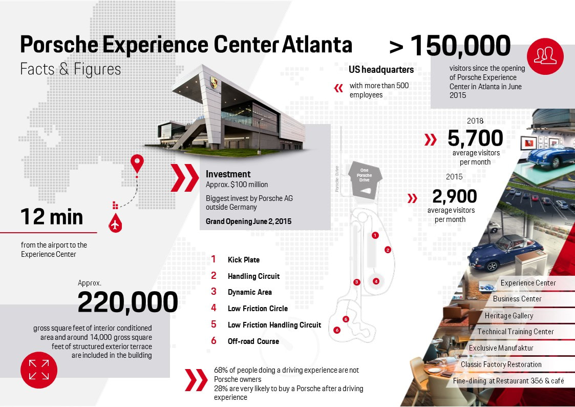
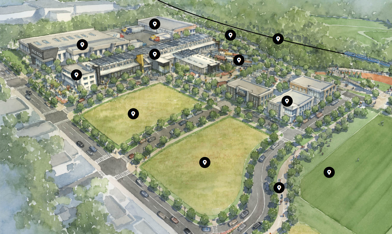
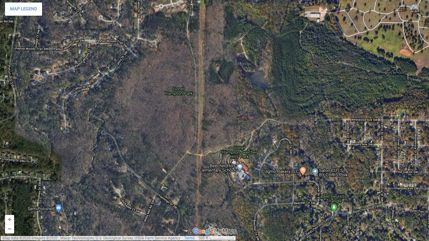
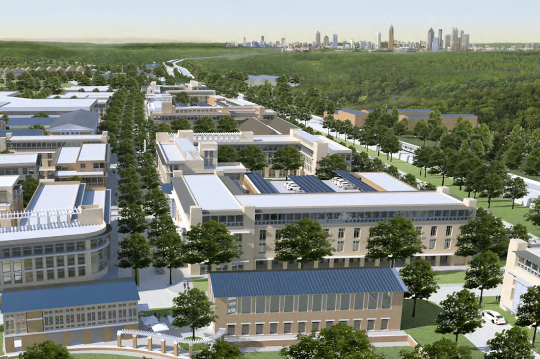
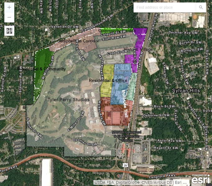
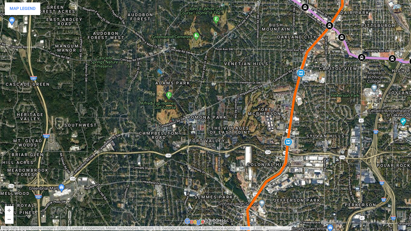
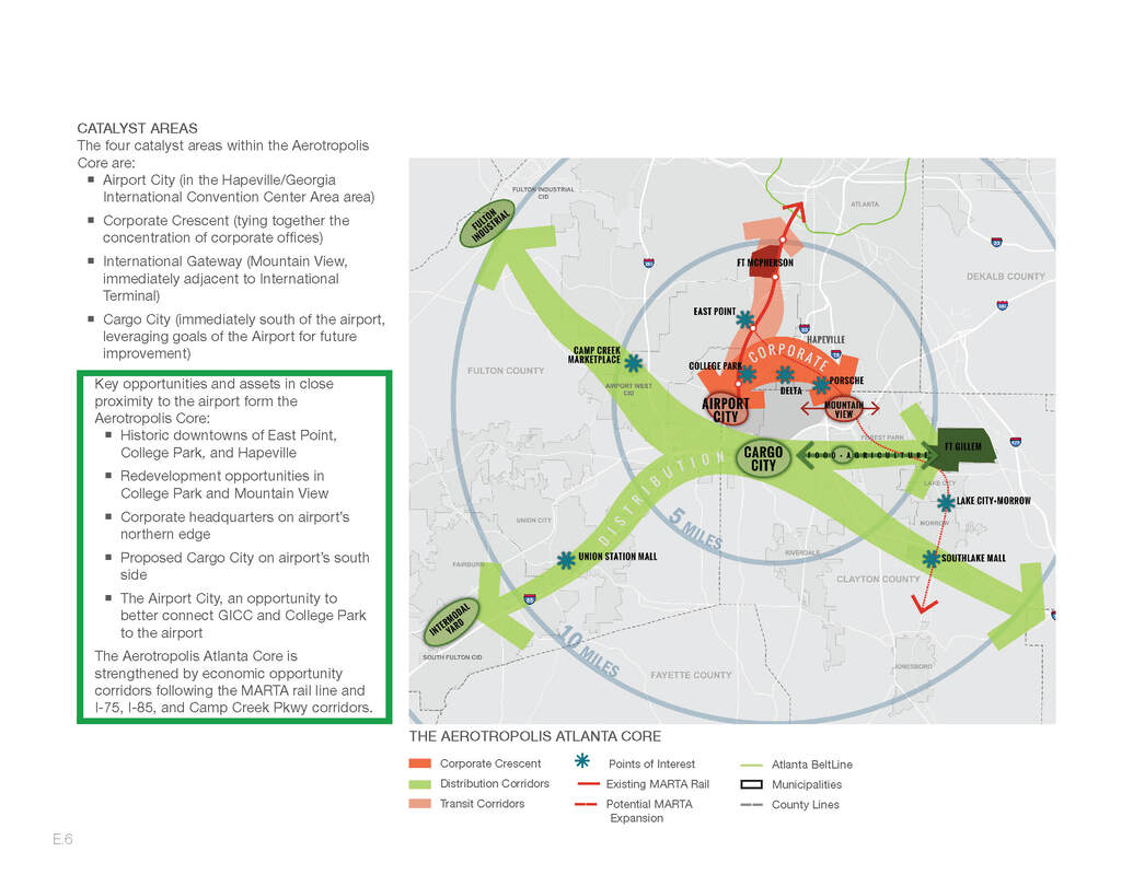
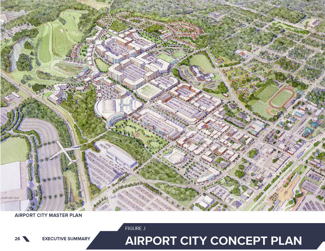
Fort Mac LRA seeks to collaborate in a variety of ways with private developers to ensure redevelopment of our 145 acres leads to a walkable, transit-oriented, mixed-use development that brings a broad spectrum of jobs, capital investment and interest to our community. In order to achieve the highest and best use of the 145 acres, we are planning necessary infrastructure improvements and expansion. Planning will leverage concepts from previous master plans, community input, and Fort McPherson’s assets.

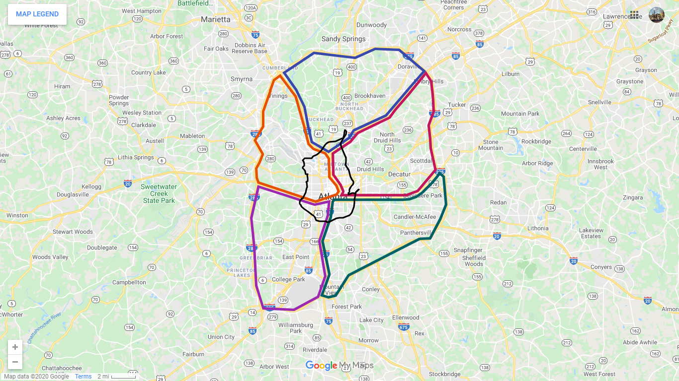
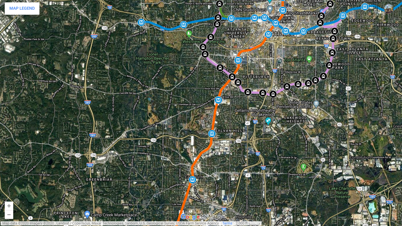
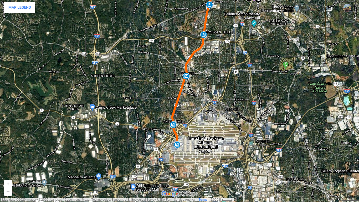
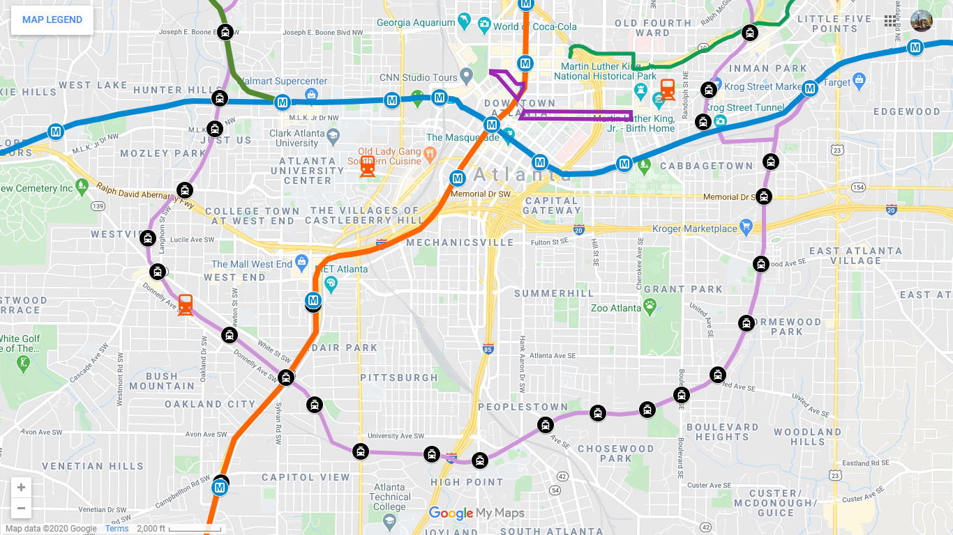
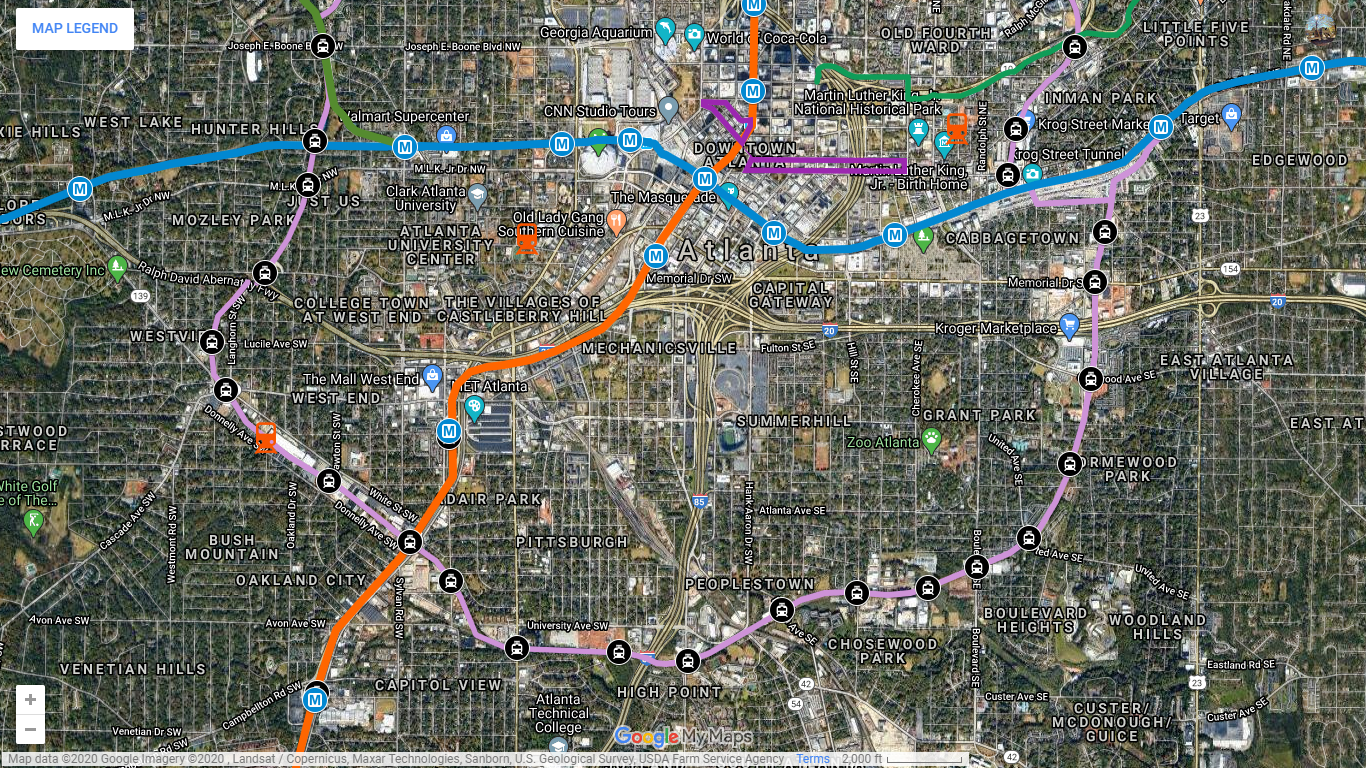
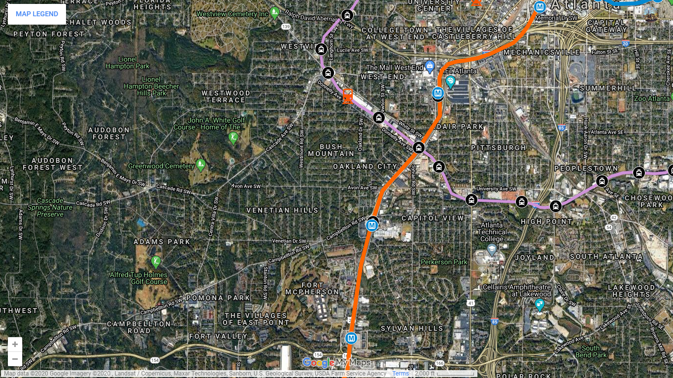
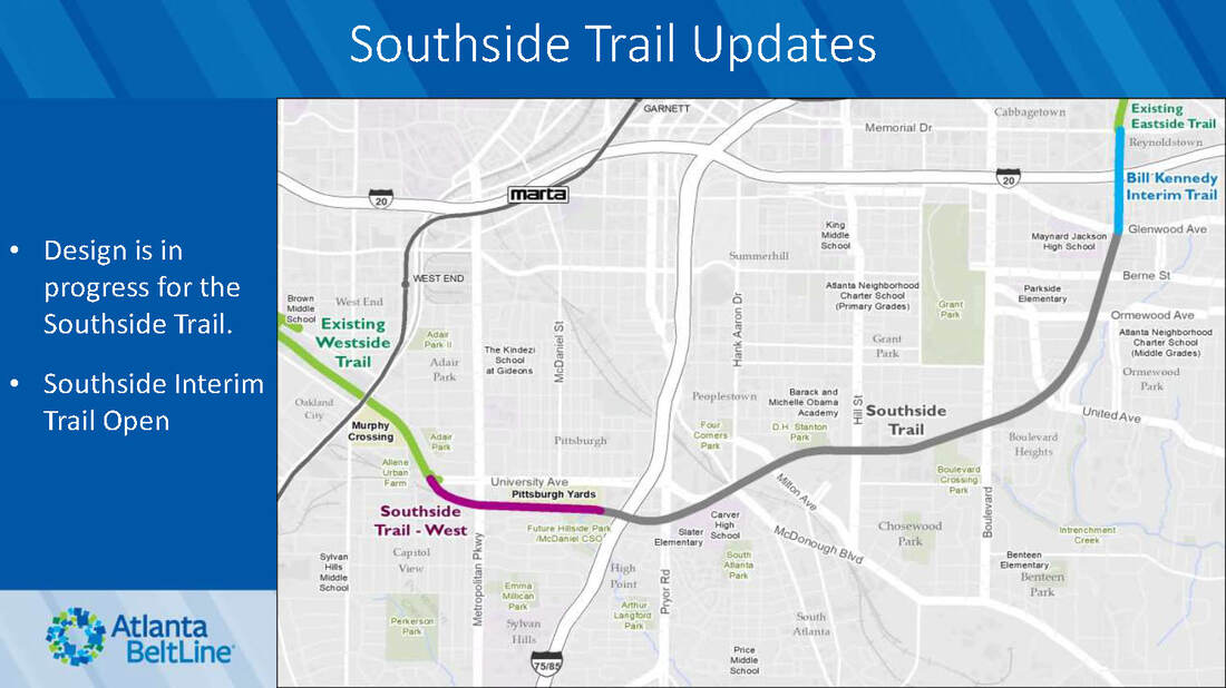
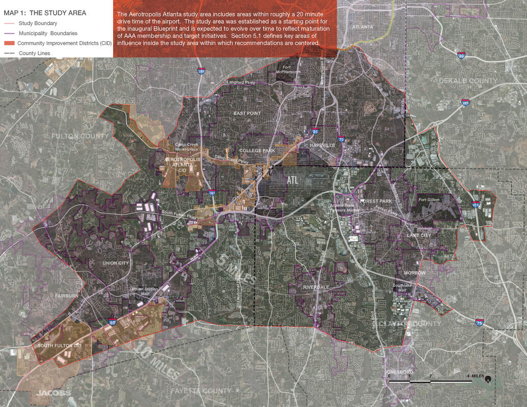
​There are seven (7) Redevelopment Districts connected by a multi-use trail. Each District is available for master planning and development that follows the concepts outlined below. Please use the interactive map to view details of each district.
INVESTOR & DEVELOPER INFORMATION

Opened: ​December 15, 1984
STATION PROFILE

Stop #12: Campbellton Road

Picture
Picture
Picture
Picture
Picture
Picture

Stop #13: East Point

The name “East Point” derives from the fact that this is the terminus of the Atlanta & West Point Railroad in the east; West Point Georgia, is the terminus where the rail line ends in the west. This settlement was founded as a railroad terminus with 16 families in 1870, but quickly became an inviting place for industry to develop. The City of East Point was chartered in 1887 and is comprised of an ethnically diverse community. Between 2010 and 2014, the overall population grew 5.3%. With over 38,000 residents, and more than 17,000 households, it’s the sixth largest city in Fulton County. Conveniently located just five minutes from Hartsfield-Jackson Atlanta International Airport, and 10 minutes from Downtown Atlanta, East Point is home to the Camp Creek Marketplace, Camp Creek Business Center, South Meadow Business Park, and several Fortune 500 Companies.
Picture
EAST POINT DEMOGRAPHICS
DOWNTOWN EAST POINT

Picture
Picture
mayor interview (wabe)

Opened: ​August 16, 1986
STATION PROFILE

Stop #14: Aerotropolis

​​The Aerotropolis Atlanta Alliance is public-private partnership created in 2014 working to improve the area around metro Atlanta’s greatest asset–the world’s busiest and most efficient airport. As a major driver of the State’s economy, Hartsfield-Jackson Atlanta International Airport (ATL) generates $34.8 billion economic impact for metro Atlanta and provides more than 63,000 jobs on-site, making it the state’s largest employer. It is also a global gateway, offering metro Atlanta residents and businesses nonstop service to more than 150 domestic and 70 international destinations. These locales include major commercial centers in Europe, Asia, the Caribbean, Africa, and South and Central America.
With this great global asset comes great responsibility to not only maintain the positive economic impact it provides to our region and State, but also to cultivate an environment of world-class commerce, infrastructure, and quality of life just outside the fence. The Alliance is dedicated to planning and implementing, in coordination with and on behalf of the unique interests of its partner local governments and businesses, this “aerotropolis”, or a vibrant community that is fully integrated in to the functions and impacts of the airport.
Picture
Picture
Picture
Picture
AEROTROPOLIS WEBSITE
INTERACTIVE MAP

Stop #15: Airport City

The City of College Park has a new master plan for the mixed-use development it plans on 420 acres it owns west of Hartsfield-Jackson Atlanta International Airport, having parted ways with the original proposed master developer. The new plan by Sizemore Group of Atlanta calls for nearly 5 million square feet of class A office, including corporate headquarters; as many as six hotels; and 758,000 square feet of retail, including multiple restaurants and a premium outlet mall. The plan would also add a 5K loop walking/running trail around the development and a golf-related entertainment venue, and it would convert the city's historic golf course to 18 holes using a reversible 9-hole design. See a summary of the new master plan here. The development site is on the north side of Camp Creek Parkway, west of Interstate 85 and Hartsfield-Jackson and across from the Georgia International Convention Center.
Picture
​The project, originally envisioned as a $500 million-plus mix of class A office, hotels, restaurants, retail and residential, debuted to great fanfare in April 2018. It represents a major step forward in making the region's "Aerotropolis" vision of denser development around the airport a reality, with the potential to create thousands of jobs and attract hundreds of millions in investment. Estimates of the project's developed value have been revised upward. "Conservatively during the first phase of the development (it) is estimated to have a developed value of over $700 million (3-5 years)," city Economic Development Director Artie Jones III said. "It is my estimation that the second phase and subsequent phases of development will surpass $1.5 billion at build out."
  • Airport City Master Plan (PDF)
  • ​Southside ready for economic success; Kemp says he’s ready to help -- AJC - 2.20.20
  • In Airport City project, College Park looks backward to look forward -- AJC, 11.19.19

Stop #16: College Park

​The community that would become College Park was founded as Atlantic City in 1890 as a depot on the Atlanta and West Point Railroad. The town was renamed Manchester when it was incorporated as a city in 1891. It was renamed again as the city of College Park in 1896. The city's name came from being the home of Cox College (where the city hall and other buildings now stand) and Georgia Military Academy (now the Woodward Academy). The east-west avenues in College Park are named for Ivy League colleges, and the north-south streets are named for influential College Park residents. ​Hartsfield–Jackson Atlanta International Airport is partially located in the city's boundaries (including the domestic terminal, Concourse T, Concourse A, and about two-thirds of Concourse B), and the Georgia International Convention Center, owned and operated by the City of College Park, is within the city limits.
Picture
Picture
​HISTORIC DISTRICT: Originating from a land grant awarded in 1846, College Park has the fourth largest urban historic district in Georgia with 867 structures on the Historic Register. The City’s historical collection consists of homes, monuments, businesses, schools, churches, parks, a cemetery, government building, and railway station. According to the federal agency, the district contains 853 recognized historical resources constructed in the late 19th and early 20th centuries. The majority of the 852 historic structures are homes of the Queen Anne style, various Late 19th and 20th Century Revivals, and bungalows of the American Craftsman style, all dating from 1882 to 1946. Other major historical structures include: The College Park Woman's Clubhouse at Camellia Hall (1927); the College Park First United Methodist Church (1904); a United States Postal Service Office (1937); four schools (constructed between 1914 and 1942); and the College Park Depot (pre-1900), part of the Atlanta & West Point Railroad.
Opened: ​June 18, 1988
STATION PROFILE

  • Wandering Atlanta’s charming Historic College Park in 15 photos -- Curbed Atlanta, 01.23.18

Stop #17: Porsche Experience Center

​The $100 million (27-acre) complex located at the Northeast corner of Hartsfield-Jackson Atlanta International Airport is the largest investment outside Germany for the sports car manufacturer. The industry-first facility is complete with a driver development track, classic car gallery, restoration center, human performance center, driving simulator lab and a fine dining restaurant. A state-of-the-art business center features 13,000 square feet of conference and event space. The experience center has been specifically designed as a destination for the public, including automotive enthusiasts and Porsche customers.

​More than 70 alternative locations in a number of states were considered during site selection. In the end, Atlanta’s transportation infrastructure, skilled workforce and strong support from the city and the state were key reasons for the decision to expand in Atlanta. The proximity to the world’s busiest airport allows approximately 80 percent of the U.S. population to reach the Porsche Experience Center within two and a half hours of flying time.
Picture
What is a Porsche Experience Center? The destinations serve as track-based brand embassies where visitors can indulge in everything Porsche. They are different than drive experiences offered by other car makers because they were purpose-designed and built to be immersive retail experiences for the public. Experience Centers do not sell cars, but they work closely with the 190 independent U.S. Porsche dealers, for example hosting customer groups sent by dealers.
​
Visitors book, at minimum, a 90-minute driving experience on road or off-road, coached by professional drivers who show them how to get the most out of a Porsche. Available cars cover all major models, from the iconic 911 to the all-wheel-drive Cayenne. Non-drivers can still get experience in a simulator lab. The centers also feature fine dining, Porsche retail stores, classic sports cars on display, and striking architecture.

Since opening, the two U.S. locations in Atlanta and Los Angeles have also become attractions for filming TV shows and movies, including “Spiderman: Homecoming” and “Captain America: Civil War,” as well as a site for marriage proposals, corporate outings, and birthday parties. The spaces can also be scaled for corporate events and other large meetings.

Atlanta opened in 2015 and LA in 2016. The U.S. locations have combined to become the most-visited of Porsche’s six Experience Centers around the world. Outside the U.S., the others are in Leipzig, Germany; Le Mans, France; Silverstone, England; and Shanghai, China. The Atlanta Experience Center is a 10-minute drive from the world’s busiest airport and offers guests a module-based, 1.6-mile driver development track, racing simulator lab, Heritage Gallery, Porsche retail store, Porsche Exclusive Manufaktur Studio, Business Center and Restaurant 356. 
  • Porsche opens new headquarters in Atlanta -- Porsche, 05.08.15
  • This Intense Porsche Experience In Atlanta Will Make You Feel Like A Nascar Driver -- NARCITY, 02.04.20
  • TripAdvisor
  • Choose Your Own Adventure